
Advanced Navigation Techniques Guide: Mastering Direction - Improve Navigation skills

Navigation Techniques: General Direction To a Certain Direction
Navigation, the art and science of determining one’s position and planning a route from one location to another, is a critical skill in everyday life and specialized activities.
This guide delves into the evolution of navigation techniques, from relying on natural indicators to leveraging technology-based innovations.
We'll explore in-depth strategies for map reading, GPS, and compass usage, offering insights into mastering directional navigation skills.
Before doing so, let’s look at the evolution of the navigation techniques.
Evolution of Navigation Techniques
Navigation techniques have evolved significantly over the centuries, transitioning from reliance on natural elements to sophisticated instruments and technologies. This journey reflects humanity's ingenuity and adaptability in exploring the world.
Ancient and Medieval Navigation

◄ Astronomical Navigation:
- Initially, navigation relied heavily on observations of heavenly bodies, including constellations and star charts. Mariners used these celestial cues to guide their voyages across uncharted waters.
- The development of the compass in the eleventh century marked a significant advancement. This early compass, made from charged iron metal, allowed mariners to determine direction based on the Earth's magnetic poles, reducing dependence on celestial navigation.
◄ Early Route Strategies:
- Mariners initially navigated by sighting landmarks and observing the movement of the sun and stars. This method restricted them to coastal navigation, only venturing into the open sea when necessary.
- The construction of the first sea vessels large enough for trading goods around 3,500 B.C. facilitated longer voyages, requiring more reliable navigation methods.
◄ Innovations in Navigation Tools:
- The introduction of the sailor's early magnetic compass was a pivotal moment in navigation history. Alongside this, creating the first maps and detailed journey records provided mariners with essential tools for exploring beyond the sight of land.
Navigation Techniques in the Contemporary Era
The 20th century witnessed unparalleled advancements in navigation technology. Innovations initially developed for wartime applications were later adapted for civilian use, transforming how we navigate our world today.
Breakthroughs in Technology
◄ Radar Technology:
- In 1935, English physicist Robert Watson-Watt developed the first practical radar system. This technology, which can detect objects beyond visual range by bouncing radio waves off them, revolutionized air traffic control, weather forecasting, and space exploration.
◄ Loran System:
- Between 1940 and 1943, the United States introduced the Long Range Navigation (Loran) system. This early electronic navigation system transmitted radio signals between stations, allowing navigators to determine their position accurately.
◄ Global Positioning System (GPS):
- Launched in 1973, GPS, maintained by the U.S. Department of Defense, represents a quantum leap in navigation technology. This space-based radio-navigation system, consisting of 24 satellites, provides precise location data within about 30 feet, speed, and time information under weather conditions.
The evolution from ancient celestial navigation to the precise satellite-based systems of today illustrates humanity's relentless pursuit of exploration and understanding of our world.
Understanding Basic Navigation Tools: Maps, Compass Bearings, And GPS
Navigating the world requires a blend of traditional techniques and modern technology. Understanding how maps, compasses, and GPS devices work is essential for anyone exploring unfamiliar territories.
🗺️ Maps: Reading and Interpretation

Maps are indispensable tools for navigation, offering a reliable source of information when technology fails. Their timeless utility makes them essential in various situations, from outdoor adventures to urban exploration.
Understanding Map Legends
Map legends, or keys, serve as essential guides for interpreting the diverse symbols that maps use to represent the world around us.
◄ Purpose of Legends:
Legends, or keys, are crucial for interpreting a map's symbols. These symbols represent components such as roads, rivers, and terrain types, providing a visual shorthand for complex information.
◄ Consistency Across Maps:
While symbols can vary, many are standardized, making it easier to understand different maps. However, it's important to note that symbols may have different meanings in other countries, particularly with U.S. map symbols.
The Significance of a Map's Title
A map's title acts as a gateway, offering the first clue to the wealth of detailed information encapsulated within its boundaries.
◄ Guidance on Map Content:
The title provides initial insight into the map's focus, whether it showcases highways, local roads, or geographical features, giving users a sense of what to expect at a glance.
Orientation and Direction
Understanding a map's orientation and direction is fundamental for accurate navigation and interpretation of geographic spaces.
◄ North Alignment:
Maps are traditionally aligned with the north at the top. An arrow or a compass rose indicates this orientation, aiding navigation by aligning the map with real-world directions.
Scale: Bridging the Real World and the Map
The scale of a map is a critical element that connects the depicted geographic information with actual distances on the ground.
◄ Interpreting Distance:
The scale is a ratio that translates real-world distances into manageable measurements on the map, such as one inch representing 100 miles, allowing for accurate distance assessment.
Advanced Navigation: Topographic Maps and Contour Lines
Topographic maps and contour lines are sophisticated tools that enhance our ability to navigate and understand the complexities of the Earth's surface.
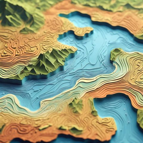
◄ Topographic Maps:
These maps offer a detailed, three-dimensional representation of the terrain on a two-dimensional surface, including natural and man-made features. They are invaluable for understanding the landscape's highs and lows, providing detailed information on mountains, valleys, water bodies, and built-up areas.
◄ Contour Lines:
Contour lines represent elevation on topographic maps, with each line connecting points of equal elevation.
- Index Contours: Every fifth line is thicker, serving as a reference point for elevation.
- Contour Intervals: The vertical distance between contour lines, indicating the steepness of the slope. Closer lines suggest a steeper slope, while wider spacing indicates a gentler incline.
- Reading Elevation: The elevation of contour lines may be marked directly on the map. For unmarked lines, the elevation can be estimated using the contour interval and examining adjacent lines.
- Interpreting the Terrain: Contour lines reveal the terrain's shape; concentric circles indicate hills or mountains, and the spaces between peaks suggest valleys or passes.
Understanding these aspects of maps enhances one's ability to navigate and interpret the surrounding environment effectively, making maps a fundamental tool for explorers and travelers alike.
For step-by-step instructions on how to read a map, watch this video for your reference:
🧭 Compass: Navigating A Destination

Navigating with a compass is a fundamental skill for outdoor enthusiasts, offering reliability when modern technology is unavailable.
Understanding the different types of compasses and how to use them is essential for accurate direction finding and navigation.
Types of Compasses
◄ Magnetic Compass:
The magnetic compass features a magnetized needle aligning with Earth's magnetic field, pointing towards the magnetic poles. This type is popular for its simplicity and effectiveness in most outdoor scenarios.
Subtypes of Magnetic Compass
◄ Among magnetic compasses, variations include:
- Liquid Compass: Encases the magnetized needle in a liquid to stabilize its movements.
- Marine Compass: Designed for maritime navigation, often featuring additional stabilization.
- Prismatic Compass: Includes a prism for precise reading of bearings.
- Base Plate Compass: Common in orienteering, combining a compass and a straight edge for map navigation.
- Thumb Compass: Designed for quick, one-handed operation in orienteering.
- Solid-State Compass: Utilizes electronic sensors, offering advantages in compactness and durability.
- Qibla Compass: Specifically designed for finding directions to Mecca.
- GPS Compass: Combines magnetic direction finding with GPS data for enhanced accuracy.
- Astrocompass: Used for navigation by the sun or stars in polar regions with unreliable magnetic compasses.
◄ Gyrocompass:
Utilizing a rapidly spinning wheel, the gyrocompass aligns its axis with Earth's rotation, pointing towards the true North Pole. It's advantageous for navigation at high latitudes where the magnetic compass may be less reliable.
Using a Compass
A compass is an indispensable tool for navigation, offering a reliable method for finding direction when exploring the outdoors or in situations where technology is inaccessible.
◄ Basic Operation:
- Hold the compass level, with the direction-of-travel arrow pointing towards your destination.
- Rotate the bezel until the magnetized needle aligns with the orienting arrow.
- Read the bearing from the index line to determine your direction.
◄ Understanding the Needle:
The compass needle rotates freely, with one end typically colored red to indicate north. This feature is crucial for orienting yourself and finding your bearing with respect to the Earth's magnetic poles.

Advanced Techniques
Navigating with a compass goes beyond basic orientation, incorporating advanced techniques such as triangulation and resection for precise location determination.
◄ Triangulation:
Triangulation involves determining a position by measuring angles to it from two known locations. It's a powerful method for pinpointing your location on a map by using visible landmarks and a compass.
◄ Resection:
Resection is used to find one's location by sighting two or more known landmarks and taking bearings to each. You can determine your precise location by plotting these bearings on a map.
Both triangulation and resection are invaluable skills for advanced navigation, enabling accurate location finding even in unfamiliar terrain.
Mastering the use of a compass and these techniques equips adventurers with the tools needed for effective navigation in the great outdoors.
For step-by-step instructions on using a compass, watch this video for your reference:
🌐 GPS: For Tech-Based Navigation

The Global Positioning System (GPS) represents a pivotal advancement in navigation technology, offering precise positioning, navigation, and timing (PNT) services.
Owned by the U.S. government, this system significantly enhances efficiency, safety, and operational capabilities in various sectors.
How GPS Works
GPS is a sophisticated global navigation satellite system that accurately provides geo-spatial positioning.
◄ System Components:
- Satellites: GPS operates using 24 satellites orbiting Earth, functioning similarly to stars in constellations for ancient navigators. Ground stations monitor their precise orbits.
- Ground Stations: These use radar to verify the satellites' positions, ensuring accuracy.
- Receivers: Devices like smartphones and GPS units in vehicles. They calculate their position by determining their distance from multiple satellites.
◄ Operational Mechanism:
- A receiver needs signals from at least four satellites to calculate its exact location, providing latitude, longitude, altitude, and precise time.
Benefits of GPS Technology
GPS technology has revolutionized navigation and tracking, offering various benefits across various sectors and applications.
◄ Real-Time Location Tracking:
This system enables monitoring of vehicles, personnel, and assets, facilitating quick response in emergencies and enhancing the ability to recover stolen property.
◄ Customizable Alerts:
GPS systems can be set to send various alerts (e.g., route deviations, idling times, maintenance reminders), helping to optimize operations and reduce costs.
◄ Driver Behavior Monitoring:
Insights into driving habits like acceleration and braking patterns can improve safety and efficiency.
◄ Historical Data and Reports:
GPS tracking provides valuable data for analyzing operational aspects, helping identify areas for improvement.
Limitations and Considerations
Despite its widespread application and benefits, GPS technology has certain limitations and considerations that users should be aware of.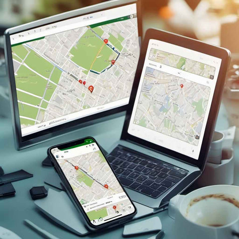
◄ Indoor Use:
GPS signals are significantly weakened by indoor environments and dense urban areas, reducing accuracy.
◄ Accuracy Limitations:
While highly accurate, standard GPS typically offers location precision within a 3-meter range, which may vary under certain conditions.
Utilizing GPS in Daily Operations
GPS technology has enhanced efficiency, safety, and convenience in personal and professional daily operations.
◄ Navigation and Route Planning:
GPS devices allow users to input destinations, offering route suggestions and real-time traffic updates.
◄ Operational Efficiency:
For businesses, GPS technology can streamline fleet operations, enhance scheduling, and reduce unnecessary fuel consumption and vehicle wear.
◄ Safety and Security:
GPS contributes to enhanced safety and security measures by monitoring the location of vehicles and personnel.
GPS technology has fundamentally changed how we navigate and manage operations across various industries.
Its integration into daily life and business operations continues to offer unparalleled benefits in terms of efficiency, safety, and global connectivity.
For step-by-step instructions on using a GPS, watch this video for your reference:
Other Navigation Techniques: Natural Indicators

Nature offers a wealth of navigational cues that have guided explorers, travelers, and wildlife long before modern navigation tools.
Understanding these natural indicators can be invaluable in survival or enriching outdoor experiences.
💫 Wildlife and Celestial Navigation
Navigational skills have been crucial for both humans and animals throughout history, with many species demonstrating remarkable abilities to use celestial cues for orientation and migration.
◄ Animals as Navigational Aides:
Many animals, including birds like mallard ducks, owls, and orioles, use natural cues such as the sun, moon, stars, and the Earth's magnetic field to navigate. Observing these animals, especially at night, can provide insights into directional cues based on their movement patterns.
◄ Stars as Guides:
The position and movement of stars have been a navigational cornerstone for centuries. Notably, stars like Betelgeuse and the North Star (Polaris) are reliable direction indicators. By observing the movement of a star relative to the horizon, one can discern cardinal directions: if a star moves upward, you're facing east, downward, west, to the right, south, and to the left, north.
🌞 Solar Navigation
The ancient art of navigation has always harnessed the natural world's elements, with the sun playing a pivotal role in finding directions.
◄ Using the Sun:
The sun's predictable path from east to west can serve as a basic compass. One can determine approximate cardinal points by placing a stick vertically in the ground and observing the shadow's direction. At noon in the northern hemisphere, the shortest shadow points directly south, with shadows moving clockwise through the day.
🌜Lunar Navigation
The moon, with its phases and positions, offers another celestial guide for navigation, revealing directions through its relationship with the sun.
◄ Moon Phases and Direction:
The moon's illuminated side can indicate the sun's current position and, by extension, cardinal directions. If the moon rises before sunset, the illuminated side faces west; if it rises later in the day, it faces east. A crescent moon's tip's orientation also provides a rough guide to the north-south axis.
Landmark Navigation
Navigating using landmarks involves identifying and using distinctive features in the environment as guides, a practice as old as human exploration itself.
◄ Landmarks as Reference Points:
Natural and man-made landmarks are practical aids in navigation, marking progress along a route, or confirming a chosen path. Distinctive features like mountains, rivers, or buildings can help travelers orient themselves, remember locations, and find their way to specific destinations.
These natural navigation techniques reflect a deep connection between humans and the environment, offering simple yet effective methods for finding one's way in the world.
Whether used alone or as a supplement to modern navigation tools, these indicators can enhance outdoor adventures and provide valuable skills in wilderness survival scenarios.
Conclusion: Navigating As A Life Skill

Navigational skills are the foundation for moving through the world, a critical ability that impacts various aspects of life, from daily commuting to adventurous explorations.
Mastery in navigation enhances safety, efficiency, and enjoyment across a wide range of activities.
KEY TAKEAWAYS
- Transportation:
IN SUMMARY, we've journeyed from the utilization of natural indicators like the sun, stars, and landmarks to sophisticated, technology-based systems such as GPS.
The transition from traditional methods to modern tools underscores the advancements in navigation technology, offering increased accuracy and reliability.
Understanding how to navigate effectively is a valuable life skill, beneficial in countless scenarios. Whether navigating urban environments, traversing wild landscapes, or exploring the vastness of the oceans and skies, navigation skills empower individuals to embark on their journeys with confidence.
Developing your navigational skills, including map reading and compass usage, is an investment in your safety and independence.
Learning to interpret maps accurately, recognize symbols, and understand scales are essential skills for any adventure.
As we continue to explore and interact with the world around us, let's commit to honing these skills, ensuring that we can navigate our way through life's journeys with confidence and precision.
📖 FURTHER READINGS: